Read this report alongside the linked primary sources. Distinguish the announced event from its potential effect on your business.
The nighttime view after Isaias
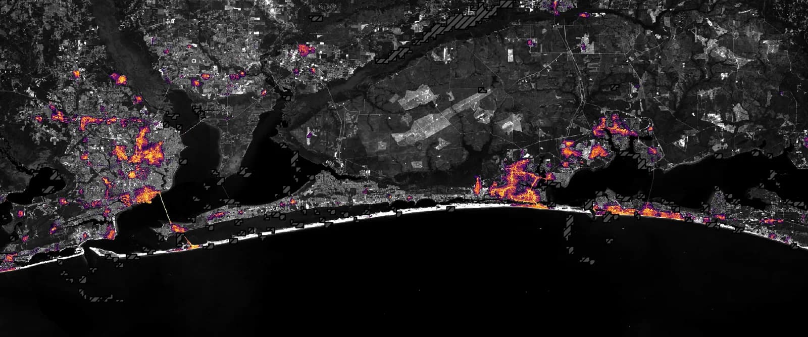
NASA published a satellite-based view of Florida Panhandle nighttime lights on October 16, comparing conditions before and after Hurricane Isaias. The report describes reduced lights around areas including Pensacola and Destin after the storm’s October 9 landfall near Destin. The imagery offers a way to study disruption and recovery across a broad area. It is not a live utility map or confirmation that a particular building currently has power. The observation date, cloud masking and processing method are therefore important parts of the image, especially for readers trying to connect a striking regional picture with a decision about one property.
Use the map to frame a verification question
A darker area can identify a place to investigate, but operational decisions require current information from the utility, property operator and local authorities. A business checking reopening should verify power, safe access, communications and the status of equipment separately. The return of lights does not automatically confirm that stock, refrigeration or every building system is ready. Keep the time of each confirmation visible so yesterday’s update is not treated as a current inspection. Satellite observations are valuable because they extend the area that can be monitored, while local verification supplies the detail needed to act at a particular site.
Build a recovery record around actual interruptions
Record when work stopped, which systems were affected, what was restored and which limitations remain. Preserve relevant photographs, supplier notices and service records without assuming that a regional image establishes an insurance claim or an assistance entitlement. For continuity planning, compare the disruption with the dependencies in the business’s existing plan: power, internet, staff access and delivery routes. Identify the practical change that would reduce downtime in a future event. The NASA report supplies a useful regional perspective, while the owner’s recovery file should explain the actual sequence at the property and the evidence supporting each decision to resume service.
Image source and usage
NASA nighttime-light map of the Florida Panhandle after Hurricane Isaias in October 2026
NASA Earth Observatory / Lauren Dauphin
Source image · Image-use terms
Web versions are resized and compressed; attribution and applicable source terms are retained.
Frequently asked questions
Does a satellite light map confirm power at my building?
No. Check current utility information, property conditions and official local instructions. The satellite image is a dated regional observation.
Sources & further reading
Source links checked October 19, 2026. Rules and availability may change; verify current terms directly. Read our editorial standards.